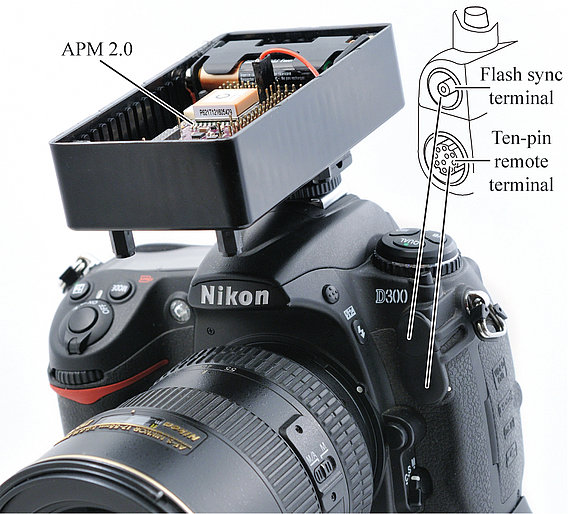
Results of the hardware approach
The first results obtained from coupling a Nikon reflex camera with a cost-effective, accurate and precise GNSS/IMU solution can be read here:
Verhoeven, G., Wieser, M., Briese, C., Doneus, M., 2013. Positioning in time and space – Cost-effective exterior orientation for airborne archaeological photographs. ISPRS Annals of the Photogrammetry, Remote Sensing and Spatial Information Sciences II-5/W1, 313–318. DOI: 10.5194/isprsannals-II-5-W1-313-2013.
Wieser, M., Verhoeven, G., Briese, C., Doneus, M., Karel, W., Pfeifer, N., 2014. Cost-effective geocoding with exterior orientation for airborne and terrestrial archaeological photography – possibilities and limitations. International Journal of Heritage in the Digital Era 3 (1), 97–121.
Both papers can be downloaded ![]() here.
here.
Automated (ortho)rectification of archaeological aerial photographs
Franz-Klein-Gasse 1
A-1190 Wien
T: +43-1-4277-40486


